 MapPalette
G20 Member Countries Map
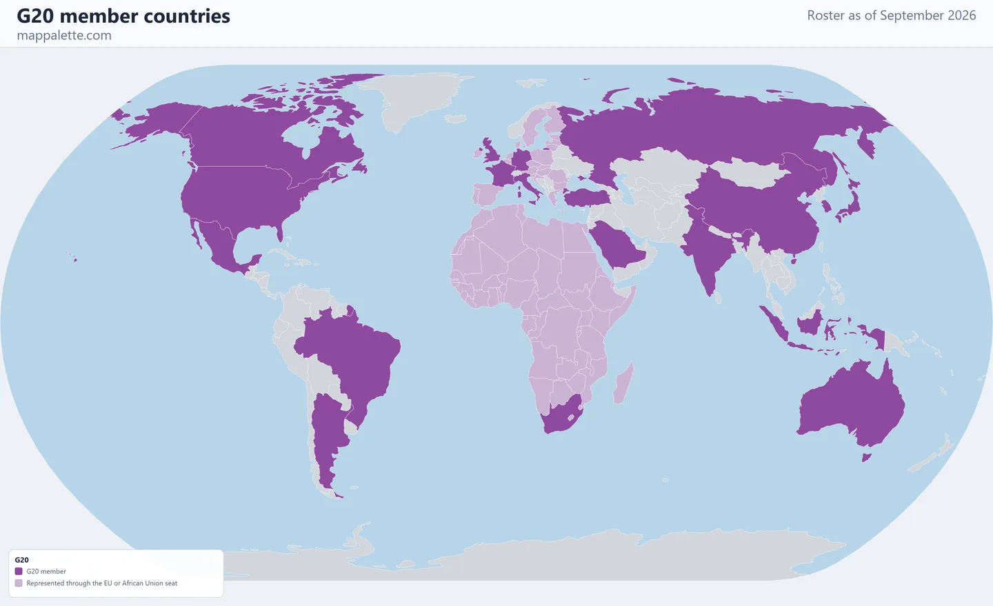
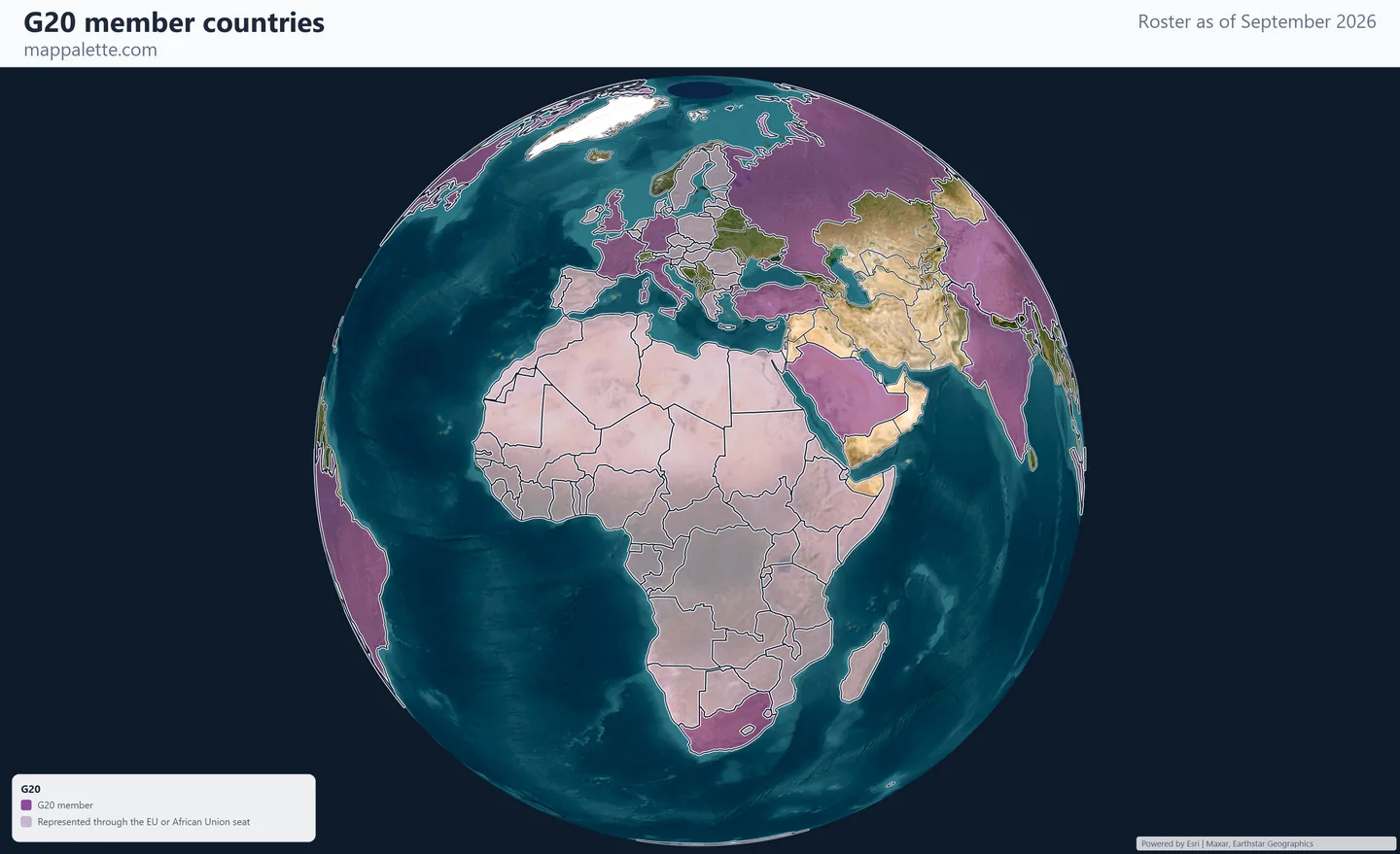
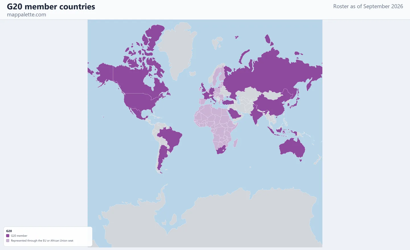
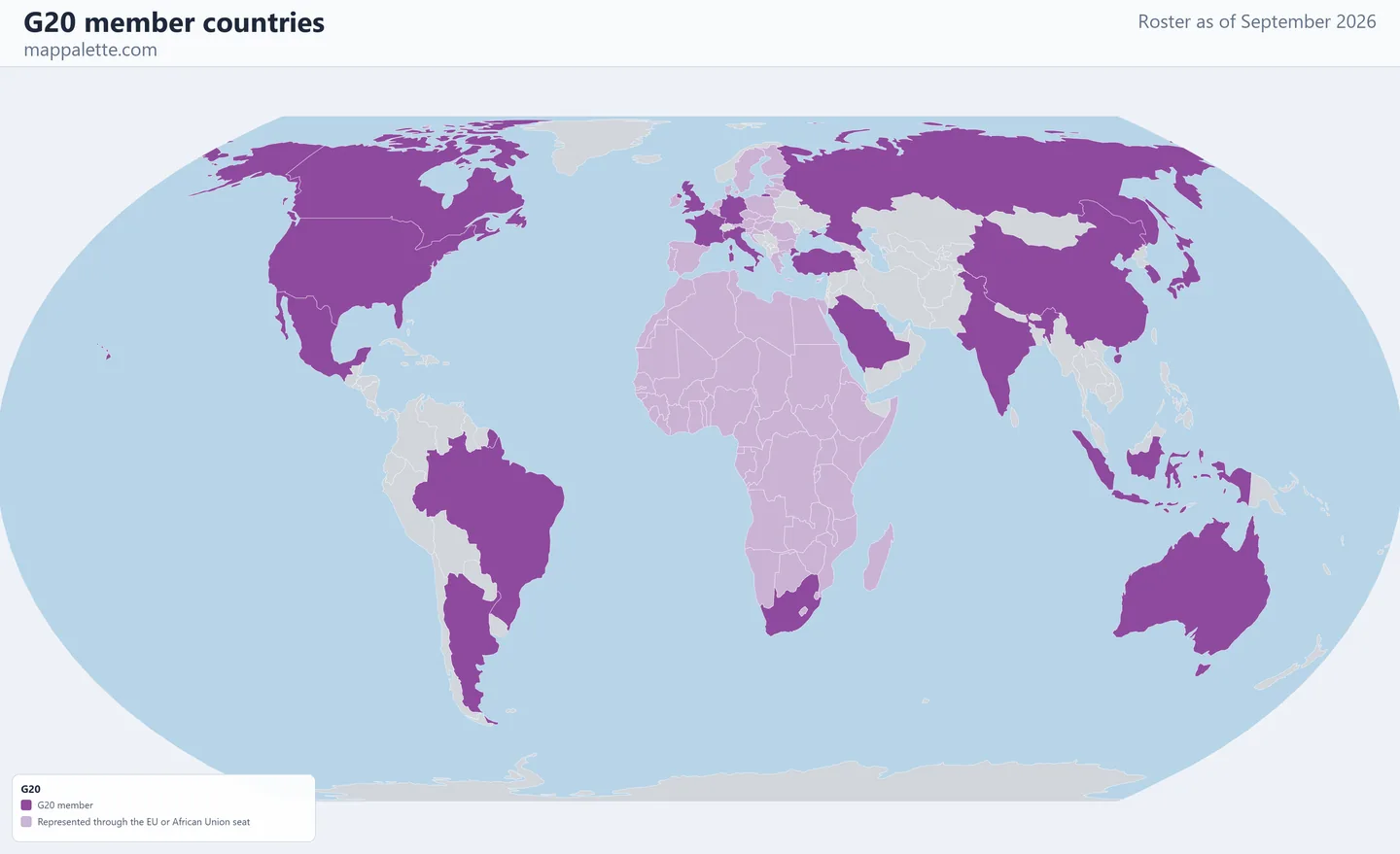
A map of the 19 member countries of the Group of Twenty, drawn from the roster as it stood in September 2026, in four map styles and free to download at high resolution.
- Members
- 19
- Founded
- 1999
- Headquarters
- No permanent secretariat; rotating presidency
- Roster as of
- September 2026
About the G20
The G20 has 21 members, but only 19 of them are countries. The European Union has held a seat since the forum's creation in 1999, and the African Union was admitted as a full member at the New Delhi summit in September 2023 — the first enlargement in the group's history.
That structure is what makes the G20 map worth drawing. The primary colour marks the 19 individual member states. The second colour marks every country that sits at the table through a union rather than in its own right: the 24 EU members not separately in the G20, and the 54 African Union members other than South Africa. Shaded that way, the forum covers most of the world's land area and roughly two-thirds of its population.
The G20 began as a finance ministers' forum after the Asian financial crisis and was elevated to leaders' level in 2008 during the global financial crisis. Like the G7 it has no treaty, no secretariat and no binding authority; the presidency rotates annually among members.
The same membership in four map styles
Every map on this page shows the identical roster — only the base layer and the projection change. Pick whichever reads best for what you are making, and download it at 3200 pixels wide.
The 19 G20 member countries
- Argentina
- Australia
- Brazil
- Canada
- China
- France
- Germany
- India
- Indonesia
- Italy
- Japan
- Mexico
- Russia
- Saudi Arabia
- South Africa
- South Korea
- Türkiye
- United Kingdom
- United States
Represented through the EU or African Union seat (78)
Algeria, Angola, Austria, Belgium, Benin, Botswana, Bulgaria, Burkina Faso, Burundi, Cabo Verde, Cameroon, Central African Republic, Chad, Comoros, Croatia, Cyprus, Czechia, Côte d'Ivoire, DR Congo, Denmark, Djibouti, Egypt, Equatorial Guinea, Eritrea, Estonia, Eswatini, Ethiopia, Finland, Gabon, Ghana, Greece, Guinea, Guinea-Bissau, Hungary, Ireland, Kenya, Latvia, Lesotho, Liberia, Libya, Lithuania, Luxembourg, Madagascar, Malawi, Mali, Malta, Mauritania, Mauritius, Morocco, Mozambique, Namibia, Niger, Nigeria, Poland, Portugal, Republic of the Congo, Romania, Rwanda, Sahrawi Republic (Western Sahara), Senegal, Seychelles, Sierra Leone, Slovakia, Slovenia, Somalia, South Sudan, Spain, Sudan, Sweden, São Tomé and Príncipe, Tanzania, The Gambia, The Netherlands, Togo, Tunisia, Uganda, Zambia, Zimbabwe
.Colour your own version of this map
The link below opens this exact roster in the world map maker, already shaded. From there you can change the colours, relabel the legend, switch projection, add pins or annotations, and export your own version as PNG or SVG.
Open the G20 map in the editor →Source for the roster: www.g20.org, checked September 2026.
Using these maps
All four downloads are free for personal, classroom, academic and editorial use — a school project, a lecture slide, a blog post, a news graphic. Boundaries come from Natural Earth, which is public domain. The satellite, street and terrain versions are drawn over Esri basemap imagery, credited in the corner of each image; keep that credit visible when you reuse them.
Please keep the "September 2026" date on the map. Membership changes, and a membership map without a date is the single most common way an out-of-date roster ends up being republished as current.
Questions about G20 membership
How many countries are in the G20?
19 individual countries, plus the European Union and the African Union as bloc members — 21 members in total.
When did the African Union join the G20?
At the New Delhi summit on 9 September 2023, becoming the second bloc member alongside the European Union.
Is Spain in the G20?
Not as a member. Spain attends every summit as a permanent invited guest, and is covered by the EU seat, but it is not one of the 19 member countries.
Other organisation maps
BRICS member countries map · ASEAN member countries map · African Union member countries map · see all 18 organisations