 MapPalette
Vietnam Map Maker — Color the Regions of Vietnam
Create a custom colored map of Vietnam online. Click any of its 63 provinces to color it, group them by color, label each group in the legend, and download the finished Vietnam map as a high-resolution PNG or scalable SVG — free and without an account.
How to make a custom map of Vietnam
- Pick a color from the palette on the left (or use the custom color picker).
- Click regions on the map to fill them with the selected color.
- Add a label for each color in the legend editor, and give the map a title.
- Optionally import name–value data to build a choropleth automatically.
- Click Download to export a high-resolution PNG or a scalable SVG.
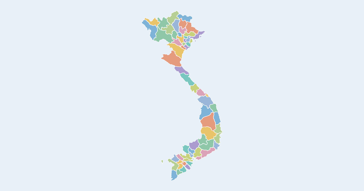
What the Vietnam map covers
The Vietnam map on this page is drawn from 63 provinces, each one a separate clickable shape. By mapped area the largest is Nghệ An (about 17,000 km², 5% of the country's mapped surface); the smallest is Đà Nẵng at about 732 km². The mapped outline reaches from 9°N to 23°N and spans roughly 7° of longitude. Some provinces are drawn as more than one piece, which is why the map carries 70 outlines for 63 provinces.
Provinces of Vietnam on this map
- An Giang
- Bà Rịa - Vũng Tàu
- Bình Dương
- Bình Phước
- Bình Thuận
- Bình Định
- Bạc Liêu
- Bắc Giang
- Bắc Ninh
- Bến Tre
- Can Tho
- Cao Bằng
- Cà Mau
- Gia Lai
- Ha Noi
- Ha Tinh
- Hau Giang
- Hà Giang
- Hà Nam
- Hòa Bình
- Hải Dương
- Hải Phòng
- Hồ Chí Minh city
- Khánh Hòa
- Kiên Giang
- Kon Tum
- Lai Chau
- Long An
- Lào Cai
- Lâm Đồng
- Lạng Sơn
- Nam Định
- Nghệ An
- Ninh Bình
- Ninh Thuận
- Phú Thọ
- Phú Yên
- Quàng Nam
- Quảng Bình
- Quảng Ngãi
- Quảng Ninh
- Quảng Trị
- Son La
- Sóc Trăng
- Thanh Hóa
- Thái Bình
- Thái Nguyên
- Thừa Thiên - Huế
- Tiền Giang
- Trà Vinh
- Tuyên Quang
- Tây Ninh
- Vĩnh Long
- Vĩnh Phúc
- Yên Bái
- Ðong Tháp
- Điện Biên
- Đà Nẵng
- Đông Bắc
- Đông Nam Bộ
- Đắk Lắk
- Đắk Nông
- Đồng Bằng Sông Hồng
All 63 are clickable on the map.
Tips for coloring the Vietnam map
- With 63 provinces, single-hue palettes read better than rainbow ones. Pick a sequential ramp, then use the legend editor to name the groups rather than the individual provinces.
- The country is far taller than it is wide, so a portrait export wastes less space — and the legend sits better in a top or bottom corner than beside the map.
- Your work is saved in this browser as you go, so a reload will not lose the provinces you have already colored.
Frequently asked questions
Is the Vietnam map free to use?
Yes — coloring and downloading the Vietnam map is completely free, with no account or watermark.
How many regions does the Vietnam map have?
The map shows 63 first-level administrative divisions of Vietnam, each individually clickable and colorable.
What are the regions of Vietnam called?
Vietnam is divided into 63 provinces, and this map draws each one as a separate shape you can click and color.
Which province of Vietnam is the largest?
Measured from the outlines on this map, Nghệ An is the largest of the 63 provinces at roughly 17,000 km² — about 5% of the country's mapped surface. The smallest is Đà Nẵng.
What formats can I export?
PNG up to 10,000 pixels wide, or SVG vector — both suitable for print and presentations.
Nearby country maps
Vanuatu map · Vatican map · Venezuela map · Wallis and Futuna map · Western Sahara map · Yemen map · browse all 250+ countries