 MapPalette
Saint Kitts and Nevis Map Maker — Color the Regions of Saint Kitts and Nevis
Create a custom colored map of Saint Kitts and Nevis online. Click any of its 14 states, provinces and regions to color it, group them by color, label each group in the legend, and download the finished Saint Kitts and Nevis map as a high-resolution PNG or scalable SVG — free and without an account.
How to make a custom map of Saint Kitts and Nevis
- Pick a color from the palette on the left (or use the custom color picker).
- Click regions on the map to fill them with the selected color.
- Add a label for each color in the legend editor, and give the map a title.
- Optionally import name–value data to build a choropleth automatically.
- Click Download to export a high-resolution PNG or a scalable SVG.
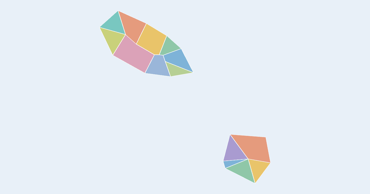
What the Saint Kitts and Nevis map covers
This map cuts Saint Kitts and Nevis into 14 regions, and every one of them takes its own color. By mapped area the largest is Saint Thomas Middle Island (about 31 km², 15% of the country's mapped surface); the smallest is Saint Paul Charlestown at about 3.7 km².
States, provinces and regions of Saint Kitts and Nevis on this map
- Christ Church Nichola Town
- Saint Anne Sandy Point
- Saint George Basseterre
- Saint George Gingerland
- Saint James Windward
- Saint John Capesterre
- Saint John Figtree
- Saint Mary Cayon
- Saint Paul Capesterre
- Saint Paul Charlestown
- Saint Peter Basseterre
- Saint Thomas Lowland
- Saint Thomas Middle Island
- Trinity Palmetto Point
All 14 are clickable on the map.
Tips for coloring the Saint Kitts and Nevis map
- With 14 regions you have a comfortable number for a 4–6 color scheme: group them by whatever you are showing, then label each group once in the legend.
- Give the map a title and name each color in the legend editor — a colored map without a legend needs a caption to explain itself.
- The share button packs the whole map into a link — colors, legend labels and title — so someone else opens exactly what you see, with no account at either end.
Frequently asked questions
Is the Saint Kitts and Nevis map free to use?
Yes — coloring and downloading the Saint Kitts and Nevis map is completely free, with no account or watermark.
How many regions does the Saint Kitts and Nevis map have?
The map shows 14 first-level administrative divisions of Saint Kitts and Nevis, each individually clickable and colorable.
Which region of Saint Kitts and Nevis is the largest?
Measured from the outlines on this map, Saint Thomas Middle Island is the largest of the 14 regions at roughly 31 km² — about 15% of the country's mapped surface. The smallest is Saint Paul Charlestown.
What formats can I export?
PNG up to 10,000 pixels wide, or SVG vector — both suitable for print and presentations.
Nearby country maps
S. Sudan map · Saint Barthelemy map · Saint Helena map · Saint Lucia map · Saint Martin map · Saint Pierre and Miquelon map · browse all 250+ countries