 MapPalette
Madagascar Map Maker — Color the Regions of Madagascar
Create a custom colored map of Madagascar online. Click any of its 22 states, provinces and regions to color it, group them by color, label each group in the legend, and download the finished Madagascar map as a high-resolution PNG or scalable SVG — free and without an account.
How to make a custom map of Madagascar
- Pick a color from the palette on the left (or use the custom color picker).
- Click regions on the map to fill them with the selected color.
- Add a label for each color in the legend editor, and give the map a title.
- Optionally import name–value data to build a choropleth automatically.
- Click Download to export a high-resolution PNG or a scalable SVG.
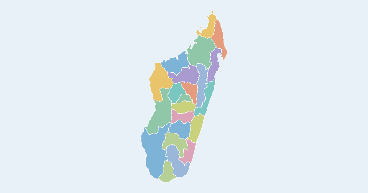
What the Madagascar map covers
Madagascar is drawn here as 22 individually colorable regions. By mapped area the largest is Atsimo-Andrefana (about 69,300 km², 12% of the country's mapped surface); the smallest is Itasy at about 6,700 km². The mapped outline reaches from 26°S to 12°S and spans roughly 7° of longitude. Some regions are drawn as more than one piece, which is why the map carries 24 outlines for 22 regions.
States, provinces and regions of Madagascar on this map
- Alaotra-Mangoro
- Amoron'i Mania
- Analamanga
- Analanjirofo
- Androy
- Anosy
- Atsimo-Andrefana
- Atsimo-Atsinanana
- Atsinanana
- Betsiboka
- Boeny
- Bongolava
- Diana
- Haute Matsiatra
- Ihorombe
- Itasy
- Melaky
- Menabe
- Sava
- Sofia
- Vakinankaratra
- Vatovavy-Fitovinany
All 22 are clickable on the map.
Tips for coloring the Madagascar map
- With 22 regions you have a comfortable number for a 4–6 color scheme: group them by whatever you are showing, then label each group once in the legend.
- The country is far taller than it is wide, so a portrait export wastes less space — and the legend sits better in a top or bottom corner than beside the map.
- Exporting for print? Raise the PNG width to 3,000 pixels or more before downloading, or take the SVG, which stays sharp at any size.
Frequently asked questions
Is the Madagascar map free to use?
Yes — coloring and downloading the Madagascar map is completely free, with no account or watermark.
How many regions does the Madagascar map have?
The map shows 22 first-level administrative divisions of Madagascar, each individually clickable and colorable.
What are the regions of Madagascar called?
Madagascar is divided into 22 regions, and this map draws each one as a separate shape you can click and color.
Which region of Madagascar is the largest?
Measured from the outlines on this map, Atsimo-Andrefana is the largest of the 22 regions at roughly 69,300 km² — about 12% of the country's mapped surface. The smallest is Itasy.
What formats can I export?
PNG up to 10,000 pixels wide, or SVG vector — both suitable for print and presentations.
Nearby country maps
Luxembourg map · Macau S.A.R map · Macedonia map · Malawi map · Malaysia map · Maldives map · browse all 250+ countries